Services
DESIGN
- Stream and river restoration
- Estuary restoration
- Floodplain restoration and mitigation
- Stage 0
- Green stormwater management
- Beaver Dam Analogues
- Fish passage
- Large wood design and engineered log jams
- Dam and barrier removal
- Multi-species habitat restoration
- Hydrologic and hydraulic modeling
- Wetland restoration and compensatory mitigation
- Bank stabilization design
- Bridge scour protection
STUDIES & PLANNING
- Hydromodification
- Floodplain regulations and ordinances
- Geomorphic assessment
- UAV/remote sensing
- Green stormwater infrastructure
- Design standards and stormwater code
- Watershed planning and analysis
- GIS analysis
- Climate change adaptation
- Channel morphology and stream assessment
REGULATORY
- Wetland delineation
- Habitat surveys (bird, aquatic, lamprey, plant)
- Clean Water Act (Section 404/401 permit applications, wetland delineation reports, and wetland mitigation plans)
- Endangered Species Act Section 7 (Biological Assessments, No Effect Memos, programmatic Biological Opinions)
- National Environmental Policy Act (Environmental Assessments, Categorical Exclusions, Environmental Impact Statement sections)
- Floodplain permitting (No-Rise, FEMA CLOMR/ LOMR)
- Water quality and vegetation monitoring
Survey and Geospatial
Topographic and UAS Survey:
- Topographic
- Infrastructure and natural features (photogrammetry)
- Construction staking and as-builts
- Inundation & vegetation mapping (multispectral imagery)
- Site reconnaissance & documentation
- Restoration & mitigation monitoring
Remote Sensing Analysis:
- Landscape scale landcover and inundation mapping
- Impervious surface mapping
- Post-fire extents and intensity
- Invasive plant detection and mapping
Advanced GIS Analysis:
- Conservation suitability and prioritization
- Wildlife corridor planning and analysis
- Watershed planning and assessment
- Channel migration and geomorphic change
- Land use/cover analysis and mapping
- Custom workflow and tool development
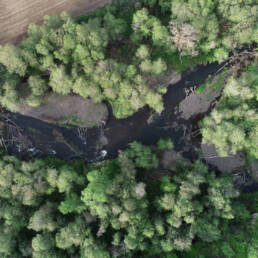
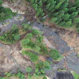
There is no one size fits all solution to restoration. Objectives vary among those for wildlife and those for people. By working with nature and partnering with people, our solutions are adaptive to natural processes and supported by the local community.
“Floodplains, river channels, plants, animals, and people—along the changing paths of rivers, streams, and wetlands—are continually shifting and adapting to natural and human induced changes within a watershed. Wolf Water Resources designs solutions that integrate the ever-changing dynamics, processes, and interconnections of the natural and built landscape.”Esther Lev